Chronsocope Hamburg
mprove innovation + interaction design, 2017
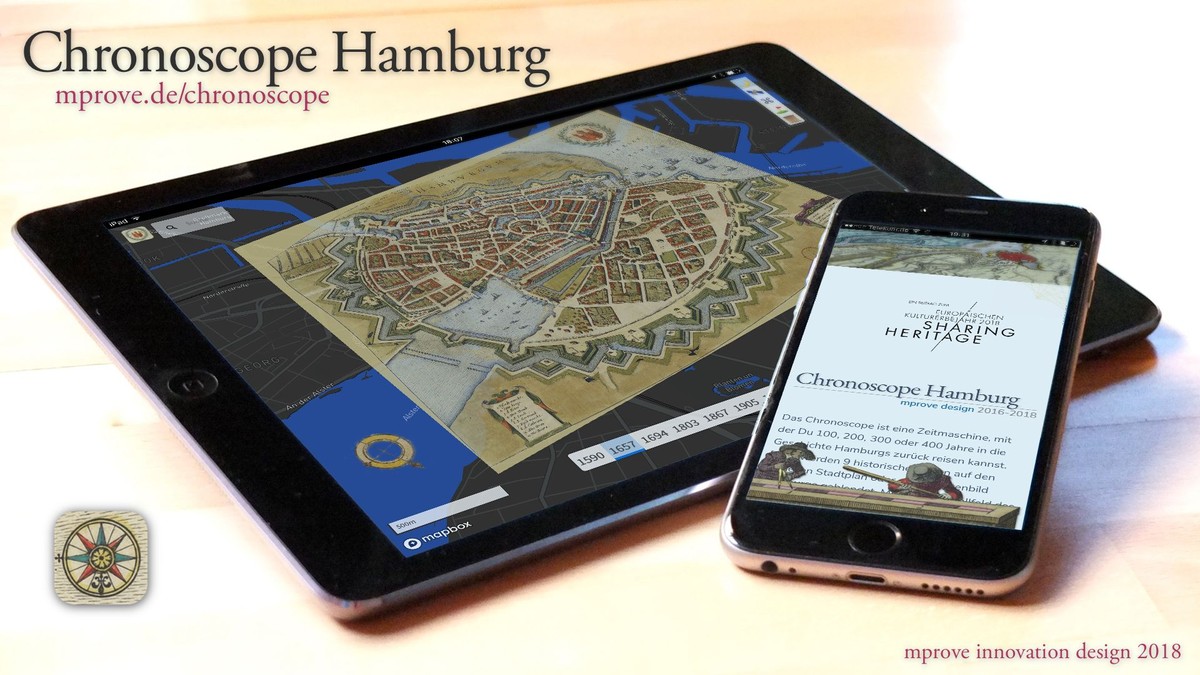
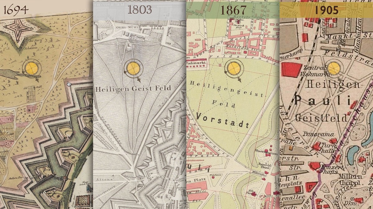
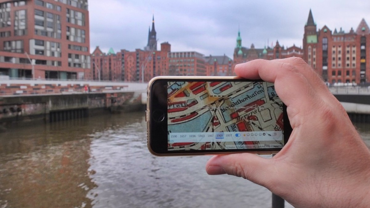
The Chronoscope Hamburg is a time machine to explore the historical topology and development of the city of Hamburg. It offers 9 vintage maps in a geo web application ? spanning the time frame from 1590 until 1937. It was necessary to align the maps to display them with high precision on top of today?s map or satellite view. The web app provides controls to zoom into the details on street and fleet level, and to compare the maps across centuries. Most prominent is the fortification of Hamburg that protected the city against the Danish neighbors in the 17th century. Later the city merged with the former Danish city of Altona. By end of the 19th century a large storage house district was built in the harbor. The so-called »Speicherstadt« and »Kontorhausviertel« are a world heritage sites of UNESCO.
It is a deliberate design decision that the Chronoscope works as a personal research medium. There are neither guided tours nor info boxes that distract the user from her own personal journey through space and time. It is one of Chronoscope?s key strength to support a self-paced discovery of streets and locations that resonate with the user?s curiosity and her own urban experiences. Furthermore it is possible to store and share locations and years with persistent »ChronoLinks«. They can be used to point a friend to a specific detail and discuss the findings together.
The maps are enhanced by two info layers. The time frame of late 1600 shows the home of about 60 Hamburg residents. They have been discovered and identified in the transcribed version of more than 10.000 pages of the High Court of Admiralty in London of the 1650s. The merchants and sailors are known by name and street address. The other info layer shows spacial info on about 75 buildings of the 1920s, mostly schools but also hospitals and ?once again? the office district Kontorhausviertel. More than 1,300 vintage architecture photographs by the brothers Dransfeld can be accessed through the interface of Chronoscope Hamburg.
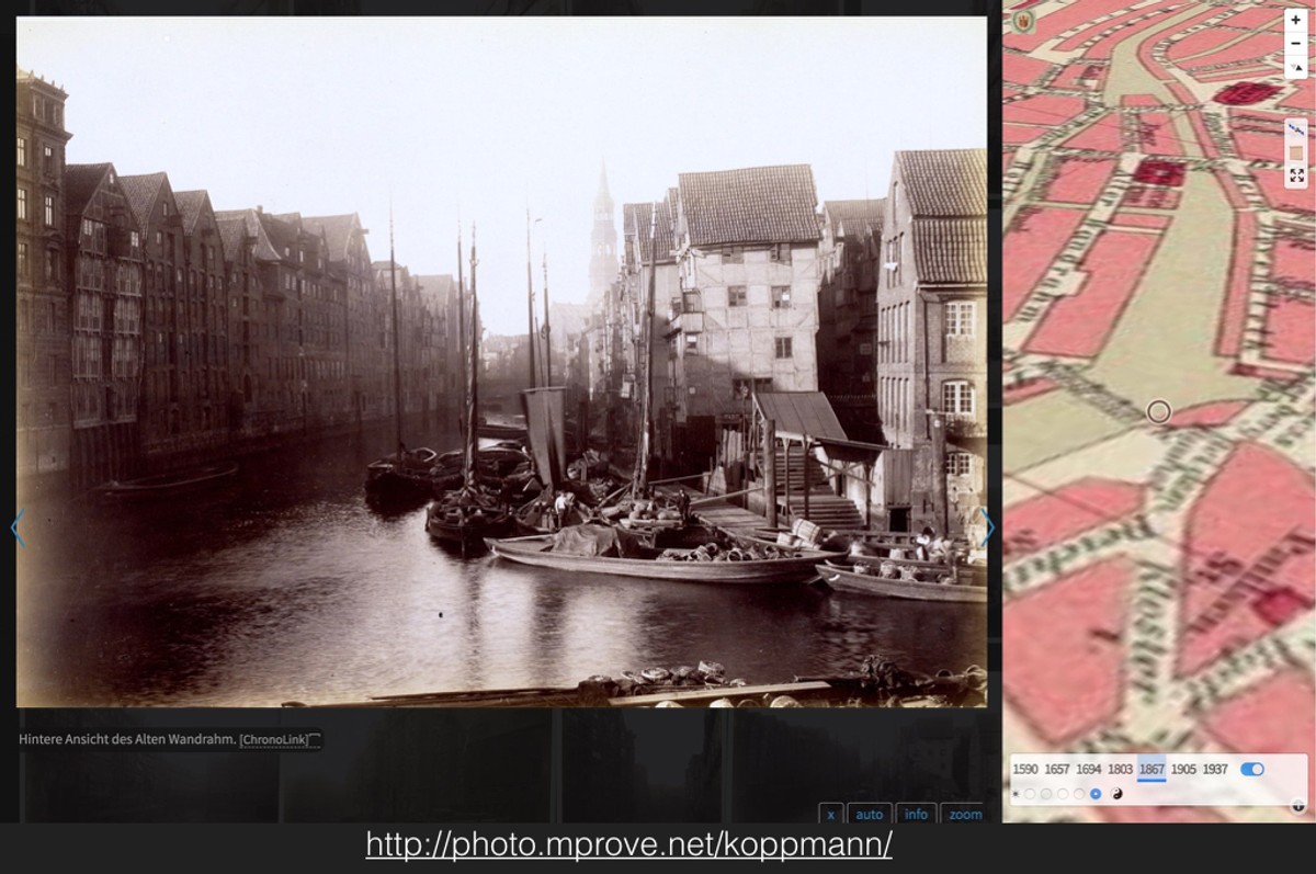
The ChronoLinks are also key to utilize the Chronoscope as a plugin in other web applications. For instance, Georg Koppman got the task to document the Brook habor district before it was demolished in 1883 and the following years to build the Speichstadt. Each photo together with a ChronoLink provides the impression where it was taken and how the area was looking 135 years earlier.
Throughout the concept and development process usability and interaction design have been a major objective. Each interactive element went through several iterations, and it was evaluated if it provides sufficient value and delight to the user. The qualities are: (i) high precision, (ii) high performance, (iii) robustness, (iv) clean layout and user interface, (v) responsive design, (vi) keyboard shortcuts, and (vii) contextual and innovative gesture controls.
Chronoscope Hamburg is a mapbox application that displays vintage maps provided under CC-BY-4.0 by the State and University Library Hamburg Carl von Ossietzky.
Links
Authors
Project Partner
Staats- und Universitätsbibliothek Hamburg Carl von Ossietzky; providing the maps under CC-BY-4.0